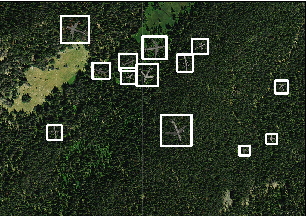
Satellite imagery provides an interesting problem. It’s becoming more and more clear, making it easier for many people to see exactly what the imagery is showcasing. However, it’s also becoming more and more revealing, making it easier for people to get a lot of information out of a single image.
That’s one of the reasons machine learning object detection has come into the limelight when it comes to satellite imagery. With a high-quality satellite imaging service and a powerful-enough AI, it may be possible for AI to tag images in real time. What’s the future look like for machine learning object detection in satellite images?
Is It Legal to Analyze Satellite Images With AI?
As of early 2020, no. On January 6, 2020, the Bureau of Industry and Security enacted a rule that stated it’s no longer legal. It’s also illegal to import or export any software that’s explicitly trained to analyze satellite images with AI. Although this ruling is technically only a preliminary and temporary ruling that only lasts for a year, it’s expected to extend the ruling further after public comment.
According to the rule, it impacts software specially designed for “training a Deep Convolutional Neural Network to automate the analysis of geospatial imagery and point clouds.” It also has to meet a number of criteria regarding exactly how it does that. For example, it must provide a graphical user interface, extract positive and negative samples, and match patterns in the geospatial imagery.
Can Companies Legally Analyze Non-Satellite Images With AI?
This has been an option for a long time now, and it seems like it’s still an option for most images. People are constantly trying to train deep learning neural networks to analyze images and determine exactly what the image is. It’s the leading concept behind a lot of automatic adult content censors on social media sites.
As the rule states, it specifically only impacts software designed to automate analysis of “geospatial imagery,” which is one of the most technical and military-centered ways to refer to “satellite imagery.” Most companies can keep developing analyzing software as long as it’s not intended to work with satellite imaging.
Are Companies Allowed to Tag Satellite Images Without AI?
Tagging satellite images is also something analysts already do. When you use Google Maps, the map you’re viewing typically allows you to see whether something is a home or not when you zoom in. That’s because an analyst has gone in and tagged the image with a specific marker regarding whether it’s a home.
Again, going back to the rule, it singles out “software,” not any individual person. The main worry of the United States government with this rule seems to be avoiding potential problems that could come from automation of real-time satellite imagery. Companies have been tagging satellite images by hand for a long time, and they’ll probably keep doing it.
Does the Military Already Have Technology to Detect Objects With AI?
This is actually a substantial military concern right now. The government’s already invested substantially into software tools that can scan images, detect potential irregularities, and transfer those irregularities to a human, who can take a look at them and determine whether it’s something to look into or not. However, it’s dealing with a serious shortage of analysts, and that’s a problem.
A good example of this is Project Maven, which is essentially trying to do this right now. It’s a government-funded project that’s intended to identify objects of interest, detect scenery changes, and uncover new things to pay attention to in an image. That way, analysts and operators can dig through video footage, satellite imagery, and other important pictures more quickly.
What’s the Future of AI Learning With Satellite Images?
If the United States government has recognized that it’s a significant enough possibility that it needs to make a ruling on it, it’s very probable that this type of AI learning is just around the corner. Although it may not be available in the United States or other countries to the public anytime soon, the government may be able to start seeing more regarding it in a surprisingly fast manner.
AI learning with satellite images definitely has a long time to go. However, deep learning neural networks can surprise even the most knowledgeable people in the scientific field. Keep your eyes open for how higher-quality satellite imaging, like the quality available through Worldview 3 satellite imagery, is going to change the game in the coming months and years with this AI detection.
